
Survival Camping Land Navigation
Amid the incredible tech being put into clothing, tents, hammocks, boots, backpacks and various other gadgets, it’s easy to forget about the humble compass. If you plan on creating a little nook for yourself in the outdoors you must get proficient at finding your way with a map and compass.
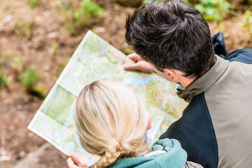
In this article, we will particularly focus on triangulating your position anywhere in the woods with a map and compass. Using these tools and the landmarks around you, finding your position is just an exercise in orientation. If you’re lost or even just a few miles off a trail this can be the difference between getting back to camp or wandering another few hours till you find a trail.
NECESSARY TOOLS FOR SUCCESS
Topo Map
The topographic map is incredibly important for anyone in the backcountry. Don’t just buy a high-quality topographic map, learn how to read it. Distance on a topo map must be understood so you can get a grip on what mountain and valley travel is all about. What may look like a short distance could be a day’s worth of hiking.
Binoculars
Using this method will require you to have a good pair of optics. You will be tasked with identifying landmarks. These landmarks could be at great distances but it will require that you can make these landmarks out for you to find your position.
You can find landmarks without binoculars but it adds a layer of assurance. Also, what are you doing in the woods without some binoculars, anyway?
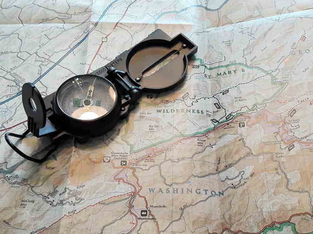
Lensatic Compass
Of course, using a compass to find our position on a map will require that we have a compass. Get yourself a decent compass if you are planning on being in the backcountry at any length. The process we are going to use for triangulating position in this article will employ a lensatic compass. This is the military issued compass but it is available at most outdoor and camping retailers. If you cannot find one there is always Amazon!
QUICK TIPS FOR LAND NAVIGATION
The Sun’s Path
If you understand the sun’s path you will be able to put a solid lock on east and west. The sun always rises in the east and sets in the west. This is well-known information but it is sometimes hard to make these correlations when you are lost or panicking.
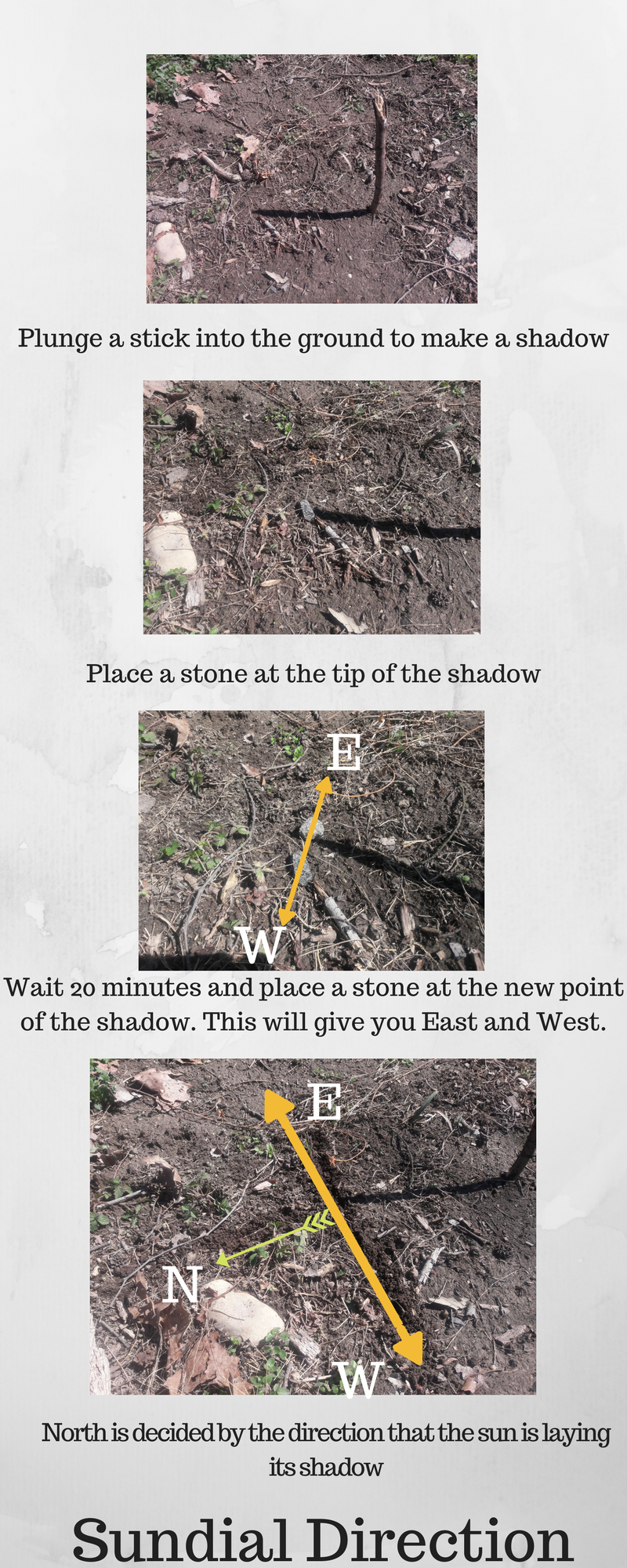
The Sundial
If you jam a stick into the ground on a sunny day the sun will cast a shadow. Place a marker, stone, coin or something else at the end of that shadow. Wait about 20 minutes and place another marker at the new end of the shadow.
Draw a line through the two markers and this will give you an East-West line. If you read our previous tip you can use the sun’s direction to give you actual East or West. Observe which side of the line the shadow is pointing over.
The sun rises in the southerly sky so rays will be pointing in a northerly direction. A 90-degree angle from this side gives you north and a 90-degree angle from the opposite side gives you south. From here you have basic direction. This can be used to orient your map and give you a bearing.
The North Star
There is a reason voyagers and explorers have used the North star to travel the northern hemisphere. Polaris will always point you towards the North. Find this star in the sky tonight if you don’t already know it. It is the brightest star in the sky.
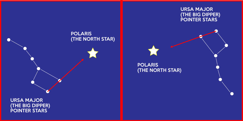
The North Star can be located using the pointer stars of the big dipper. The pointer stars are the brightest two stars that make up the portion of the constellation furthest from the handle. If you follow the imaginary line created by those two it will guide you right toward Polaris. You can also find Polaris off of the constellation Cassiopeia, which looks like a W. Polaris is between the two on that same imaginary line that connects at the middle peak on the W of the constellation.
LOCATE YOURSELF
Assuming you adhered to our section about tools you will have a quality topo map for navigation. At this point, those binoculars are going to start to come into play. Before looking at that map you must scan the land around you. This is best done from a high point if possible. High points are great places to do this because they usually show up on maps.
The reason we want to survey the land before eyeballing the map is so you don’t create bias. The map may tell you things about landmarks that will begin to disorient your actual perception. During observation pick out three key landmarks on the horizon or in the immediate area.
Great examples would be:
- Structures
- Rivers
- Streams
- Peaks
- Trails
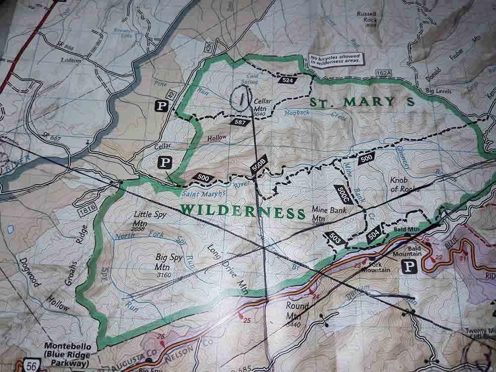
Now open the map and begin to put the pieces together. Try to match up your findings with landmarks on the map that look like those in your area. See the example below.
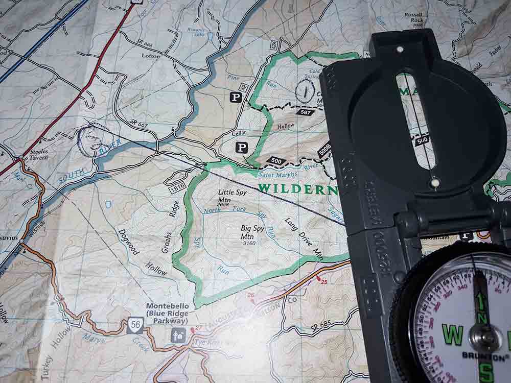
From here you must orient the map with your compass by placing the the left or right border at absolute north. In other words, the maps north must line up with true north. This may require you to spin a bit or for you to spin the map.
Place the compass on the map in the direction of your travel or the direction of the landmark. Place your direction of travel over one of your identified landmarks. Pivot the compass until it reads true north. Make sure your mountain or stream stays in the direction of travel. Now, draw a nice long line along the base plate.
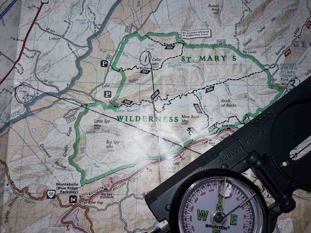
Do this with your remaining two landmarks and at some point, these lines will intersect. Where the three of them intersect, you will have triangulated your position.
Also read: Safety in the Wild: The Ultimate Survival Shelter Guide
Do not wait till you need this method to try it. Next time you are out, give it a try. Here are some important tips to remember when using this method.
- Get to high ground
- Orient your map and compass
- Always point the compass in your direction of travel when drawing your lines
- Place the center of your compass on the landmark and draw the line on the base
Triangulating is a big scary word for finding yourself. Don’t be terrified by the process of using a compass or the idea that it’s something you cannot figure out. Give it a try! (via beyondthetent.com)
![]()
Self-sufficiency and Preparedness solutions recommended for you:
Lightsoutusa (You will have communications in ANY TYPE of disaster.)
Survival MD (Knowledge to survive any medical crisis situation)
Survival System (Learn The 7 Secrets Every Family Must Know To Survive Any Disaster Or Crisis)
Survive After Collapse (Survival Secrets That Actually Help You)
Thank you for sharing your knowledge. My question is I have been observing the position of the North Star for the last 4 years and I have noticed that our Northstar at times appears to be below pointing South and I’m wondering if you know anything about this.
And it also appears to be a fact that our toilets have flushing backwards and at times it flushes straight down